Part 3: Seeing the forest floor through the trees
In Part 1 of our Walking Through Fire series, we discussed how post-fire vegetation bounces back. In Part 2 we looked at animals’ attraction to fire. But what did the fire uncover about the landscape itself?
The Jasper 2024 fire exposed an epic story of the shaping of a landscape.
It is a chilling tale of glacial force, raging waters, and human activity. It all adds up to quite the thrill for a geography major, who typically studies geomorphology by reading textbooks. Now, simply from taking in the new views – whether hiking to Old Fort Point or driving down the Icefields Parkway – we can see the land showing its primordial plotline.
Take a drive from Jasper townsite, heading south. Ignore the burned forest and look at the landscape. An ice age story reveals itself. Notice the differing elevations, the boulders littering the forest floor. Upon closer inspection, you might see random piles of rocks, lakes in impossibly round forms, and cone-shaped hills so uniform you might think humans made them.
Many of these features were crafted by the retreat of the last ice sheets that covered the Rocky Mountains. This chapter of the landscape saga started over 12,000 years ago, during the end of the last ice age, when valleys, more than a kilometer thick with glacial ice, began to melt. Today, with the land exposed by fire, we can see the results of both the ice and the power of melt water.
We can start to uncover this story not far from the Jasper townsite.
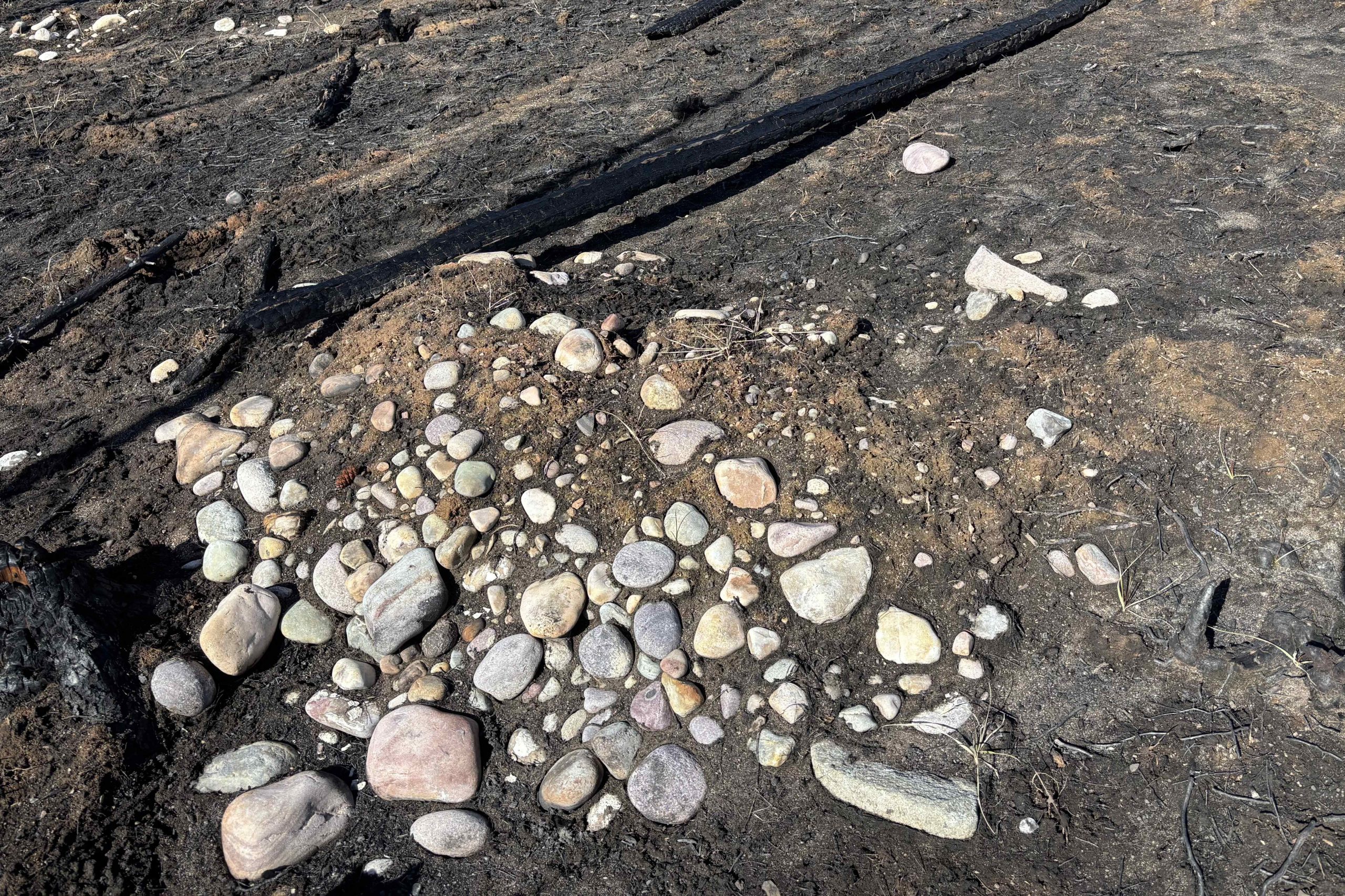
When we cross Highway 16, heading south on Athabasca Road (93A), peering to either side of the road reveals where the forest recently hid a turbulent past. Thanks to the fire, now we can see boulders strewn everywhere. Notice that most of the rock is rounded, giving us a clue that the boulders were transported a great distance in tumultuous, fast-running water. The glacial meltwaters acted like a giant rock tumbler, rounding and smoothing these geological hitch hikers before spitting them out in the flat valley bottom.
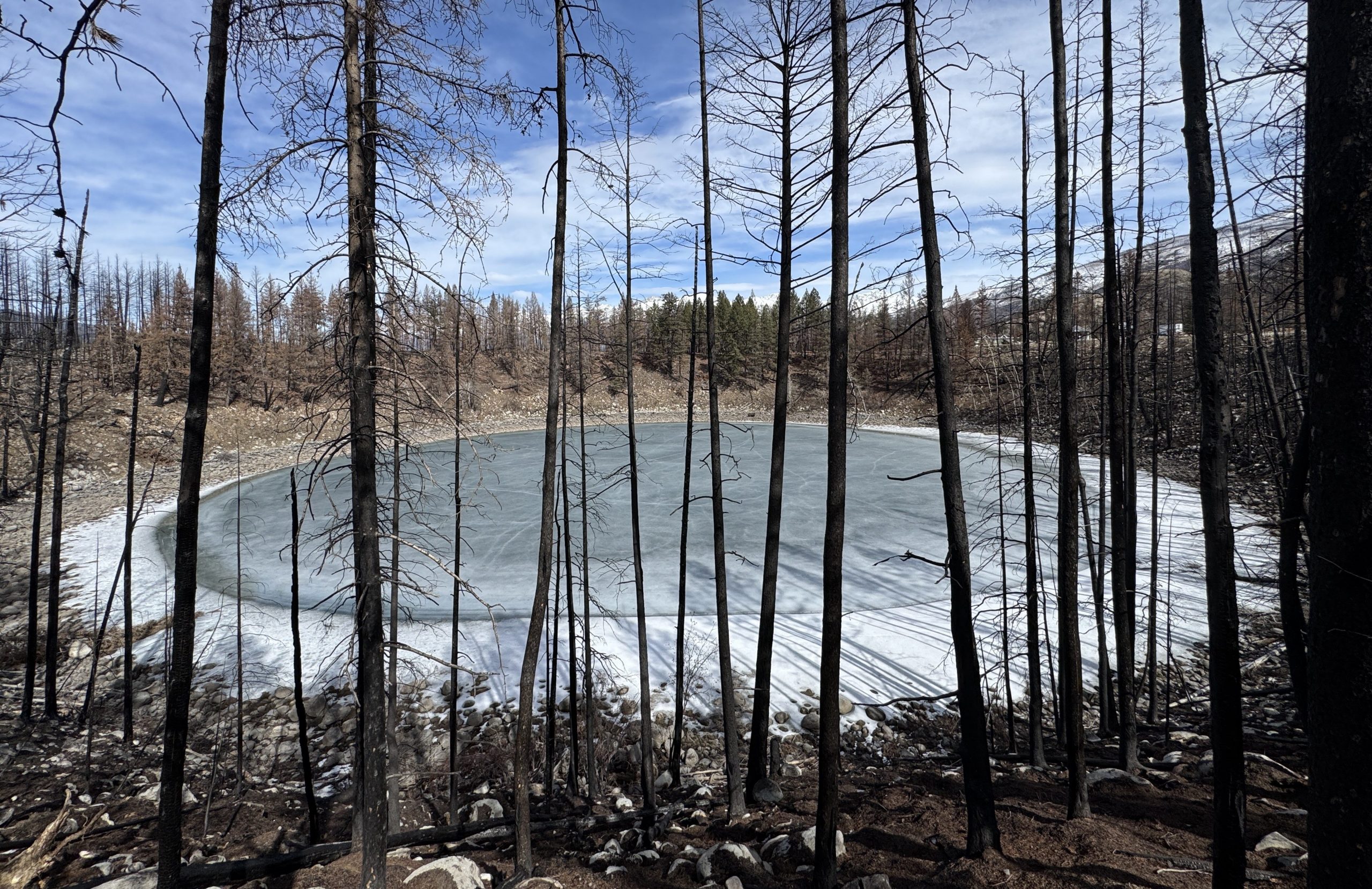
On that same drive, just before the Tekkara Lodge property, travellers can easily spot a fascinating type of lake, known as a kettle lake. This spot was once covered by a glacier. Sand and gravel, carried in meltwater on top of the ice, eventually settled out here. The resulting thick accumulation of debris prevented heat from reaching the ice beneath, so when the glacier melted back, an insulated, monster block of ice remained. Eventually, this monster melted, and the settled-out sand and gravel fell into the depression it left behind. A text-book kettle lake (known locally as Dead Man’s Hole) is now on full display – 11.6 meters (38 feet) deep and perfectly round.
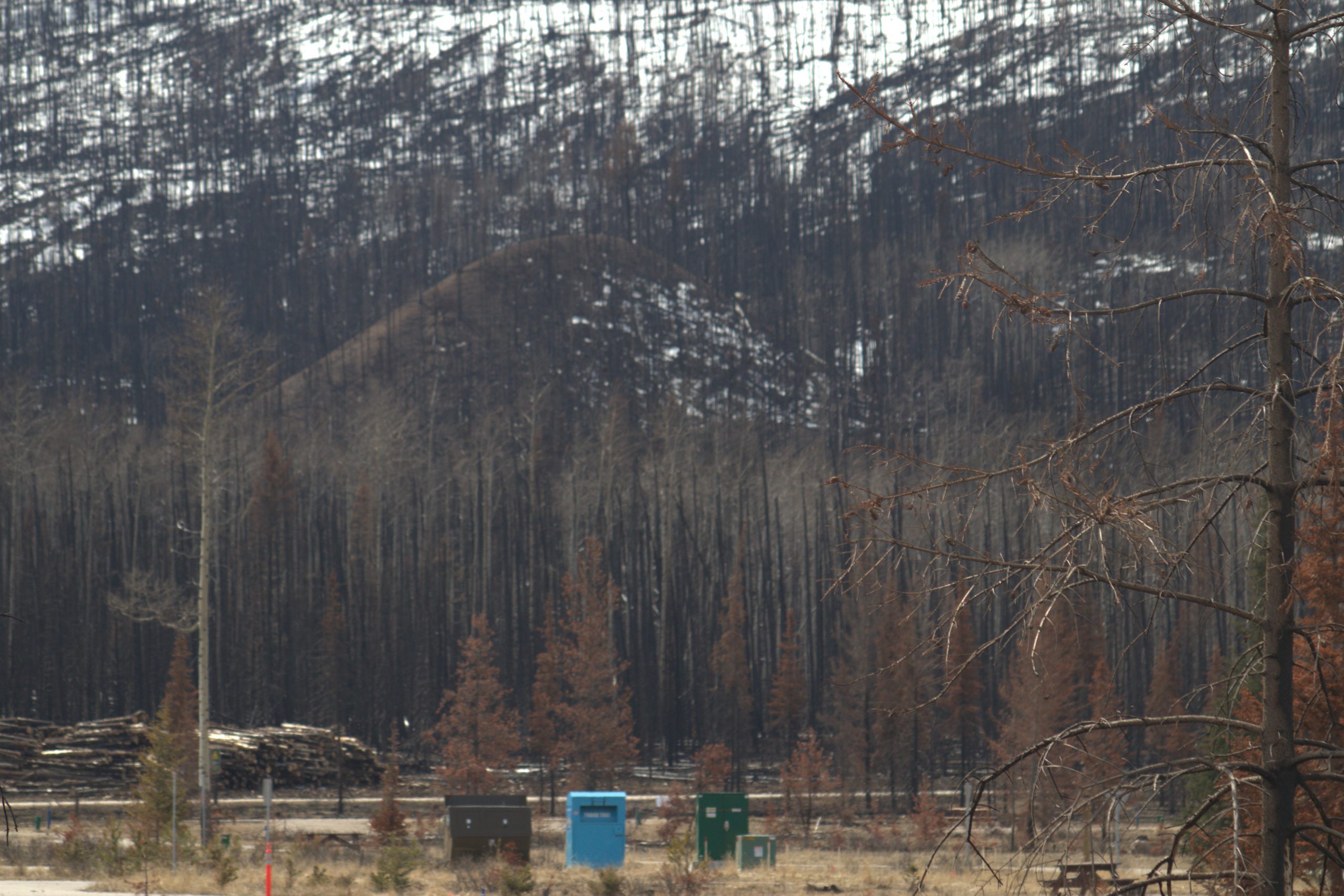
Kettles give us a clue that we should be looking for kames. As you drive south on the Icefields Parkway, peeking out from behind Marmot Meadows’ interim housing community, you can see a cone-shaped hill. It is the kind of shape you might see if you slowly dumped out a bucket of sand on the beach. This feature, known as a kame, was formed when the glacier actively melted. Where deep hollows in thinning ice developed, meltwater deposited gravel and sand into the depressions. When the glacier melted back, these cool cones were left intact.
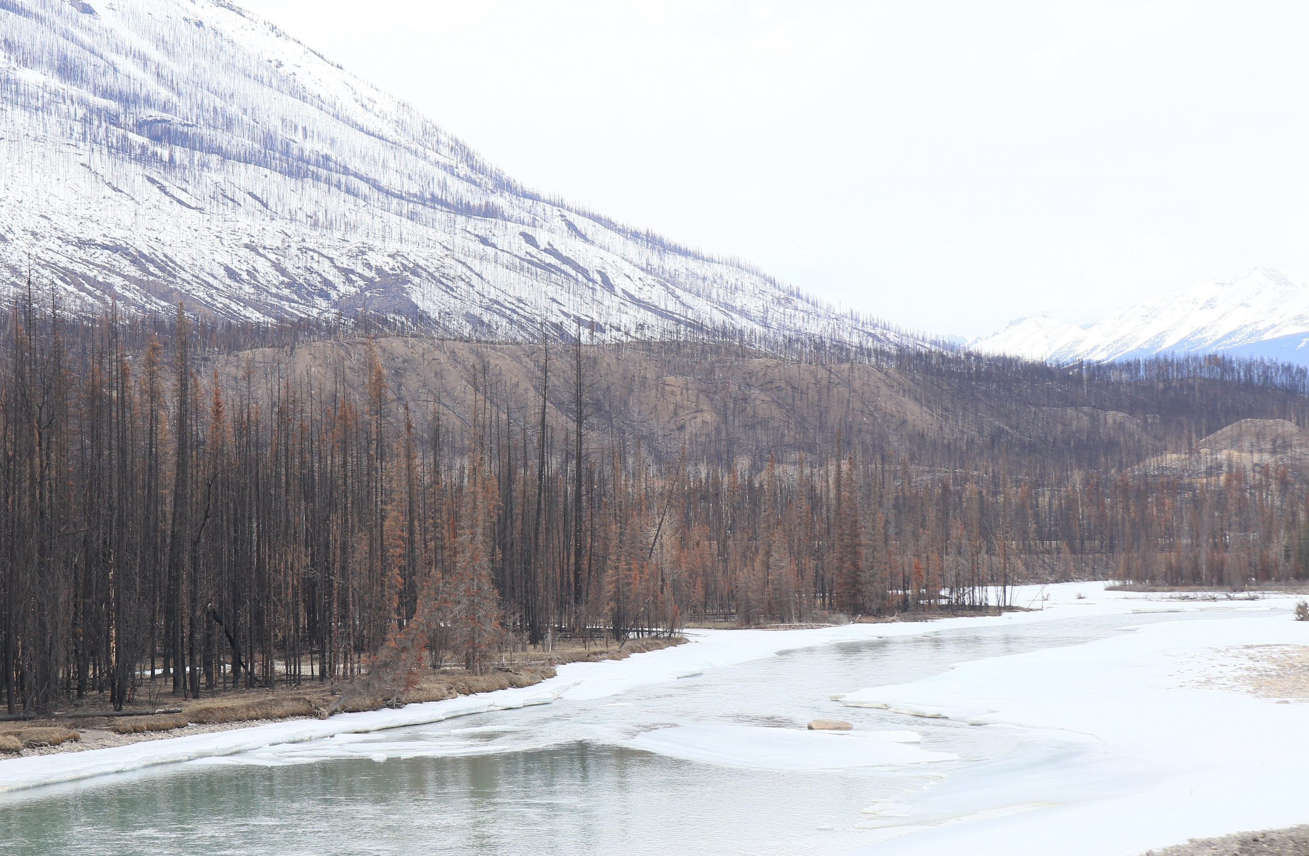
Travelling along this section of the Icefield Parkway is a good time to look for defined flat terraces. You can see them best when you look out across the Athabasca River. These features are a legacy of a past river system that happened during an older glacial melt period. Looking at the terraces you get a feel for the power of glacial meltwater as it wore down the earth it flowed over.
Humans on the move
After all the drama of ice and floods from glacial meltwater, people quickly started returning to the mountains. Archeologists often head to post-fire areas looking for artifacts left behind from cultures that inhabited these mountains for thousands of years. If you run into any, leave them where they are and contact Parks Canada. Artifacts are best left in place to give context to their story.
On my walks, the fire has revealed glass pop bottles and beer bottles, telling me there was a boozy litterbug period in our not-so-distant past.
And what about all the graves we will run into? Mike Dillon, Jasper’s former Parks Canada History specialist, predicts a trend of newly-discovered burial sites. Most of these, Dillon suggests, will turn out to be merely the interesting aftermath of a tree’s last stand, because when a tree topples over, sometimes the roots get pulled out of the ground. Rocks which the roots clung to are brought up by force, and eventually, the soil and roots disappear, leaving grave-shaped mounds of rocks. Without the right context, this sight can make for spooky sights in darkened forests.
After the fire, it might seem we can’t see the forest for the burnt trees. Instead, we get to find stories once hidden under a thick green shroud. An entire unveiling of the land’s history awaits your discovery.
Kirsten Schmitten // info@thejasperlocal.com
About the author:
Kirsten Schmitten is a certified Master Interpretive Guide and a writer who loves All Things Wild. Want to learn more? Book one of All Things Wild’s guided hikes, talks or step-on guides to find out about Jasper’s natural and historical stories. Call 780-931-6044 or visit allthingswild.ca